Woodstock Tower Field Trip
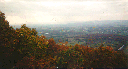
View of the Meandering Shenandoah River
 Directions to Woodstock Tower via Front Royal, Virginia leaving from the Lord Fairfax Community College parking area:
Before leaving the school, note the flatness of the valley, the Blue Ridge to the east, the Massanutten to the south and the Appalachians to the west.
Take I-81 south to I-66 and drive toward Front Royal. On 66, you are crossing an area of shale. Visible to your right is Signal Knob, the end of the Massanutten used by the troops during the War Between the States for look-out and signaling purposes. Approaching the second overpass, the big community of Reliance is to your left. You should be able to grasp the overall smoothness of the Shenandoah Valley on this trip.
Turn south, right, on Route 340. The small stream to your right marks the contact point between limestone to your left and shale to the right. Visible to the left of the road is limestone. See an erosion feature; the gully in the hill to your right and the pumping station.
Cross the North Fork of the Shenandoah and take Route 55 toward Strasburg. Follow Route 55 to Waterlick. Turn left on Route 678 and travel toward Fort Valley. Shortly, you pass through a water gap, built by that little stream to the left. You will pass Blue Hole – ask the Warren County natives about the fun to be had here. The rock is Tuscarora sandstone, very hard and with some iron. It forms the ridges of the Massanutten. You should note the stream channels and the tilt of the rock layers. You will pass Elizabeth Furnance. A nice picnic area, with a short walking tour of an actual iron furnance. It’s about 15 miles from Waterlick to Detrick.
Continue on Route 678 to Detrick and turn right on Route 758 before you pass the fire station. You will now travel about eight miles to the top of the Massanutten. The Fort Valley was once a resourt area. Some of the buildings at Detrick were once small hotels. Have you ever heard about the resort area of Seven Fountains?
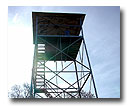
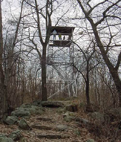
At the top of the mountain, park on the right and walk left to the tower. Note the gap to the east you passed through. As you walk to the tower, you pass over an old stage road that went to Woodstock. From the top of the tower you will be treated to one of the most spectacular views of the Valley. West are the entrenched meanders of the Shenandoah River. If your car has good brakes, you may want to descend the mountain to Woodstock, if not, retrace your route.
 Directions to Woodstock Tower from Woodstock, Virginia:
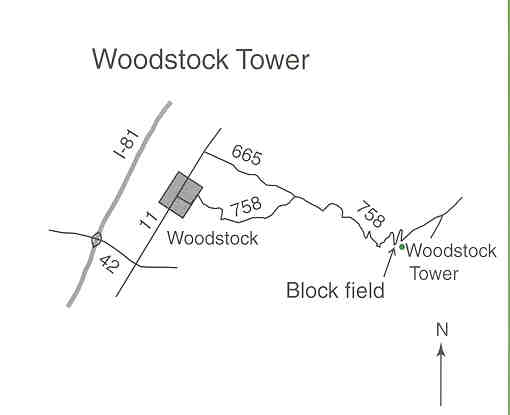
From I-81, take the Woodstock exit. Go east on Route 42 for 0.7 mile. Turn left on Route 11. Go 1.7 miles to the intersection with Route 665 (Mill Street). Turn right and go 1.5 miles to a stop sign at the intersection of Route 665 with 758. Turn left onto Route 758 and drive carefully for about 2 miles on the steep road winding up the mountain. Block fields can be seen on the slopes above and below the road. Continue to the Woodstock Tower parking area to turn around. Sandstone forms the resistant ridge beneath the Woodstock Tower and is the material of the block fields.
 Print out a copy of the brochure, "Glimpses of the Ice Age from I-81" to take along with you on this field trip. This publication can be downloaded from http://pubs.usgs.gov/gip/i81/i81.pdf. You will need Adobe Acrobat Reader to access and print out the brochure.
Look at the information on the Passage Creek Field Trip.
Map and directions from a USGS brochure, "Glimpses of the Ice Age from I-81"
Return to Top of PageReturn to Field Trips Page
Return to Dick's Page